|
Central Highlands
Aonach Beag and Aonach Mor Our friend Fergal McErlean was inviting contributions to a magazine called YourWalks, of which he was associate editor. Unfortunately, the magazine folded after only one issue, so here is a draft of a route description which I had intended to submit. Please note that no grid references or spot heights are included. These two Lochaber giants can be easily bagged from the top station of the Nevis Range ski-lift. The “traditional” route from Glen Nevis, by contrast, provides a superb day out, which is one of the classic walks of the Central Highlands. It is best reserved for a clear day, both for its outstanding views and for the navigational difficulties on the descent to Coire Giubhsachan. 1) Follow the Glen Nevis road from the roundabout near the north end of Fort William to the car park at its end. Walk up the path through the steep wooded Nevis Gorge to emerge at Steall flats, with the Steall Falls, spectacular after rain, prominent on the south of the river. Follow the eroded path skirting the flats, noting the wire bridge which accesses Steall Hut on the other side of the River Nevis. Follow the path until a bridge over the Allt a’ Giubhsachan and the ruins of the old farmstead at Steall are reached. 2) It is possible to climb towards the coire cradled between Aonach Beag and its subsidiary top, Sgurr a’ Bhuic, then swing northward onto the Southwest ridge of Aonach Beag. However, the route leading more directly up Northeast from Steall towards Sgurr a’ Bhuic is superior, as there are ever-increasing views of the Mamores to the South to compensate for the steepness of the climb. There are a number of faint paths- keep aiming for the Southwest ridge of the Sgurr. Eventually you will arrive at the top of the Sgurr a’ Bhuic, from where can be seen the long wriggling spine of the Sgurrs Choinnich and the Grey Corries enclosing the northern side of upper Glen Nevis. 3) Descend fairly steeply to a col, traverse a subsidiary top, then climb to Stob Coire a’ Bhealach. From here follow the elegantly curving ridgeline northwest to the summit of Aonach Beag. Enjoy the vista; for to the West the great cliffs of the North face of Ben Nevis tower high above the Carn Mor Dearg Arête. 4) The way onward to Aonach Mor is straightforward in clear conditions- descend northwest to an obvious col. Climb gently again where the path onward to the summit is composed of two deeply eroded parallel trenches leading across the expansive, almost flat plateau. The substantial summit cairn is close to the steep west face of Aonach Mor, which is seamed with ribs and gullies. The tapered summit of Carn Mor Dearg now lies between the viewer and Ben Nevis, while the pinnacled East Ridge of Carn Dearg Mheadhonach may excite the interest of the scrambler or winter mountaineer. To the northwest a vast playground of peaks draws the eye, and a game of “name that hill” may ensue. 5) It’s time to return to one’s starting point. Head southward again, but diverge from the eroded “tram lines” to keep the western cliffs close. After 700 metres, a small cairn marking the top of a steep, eroded path can be seen. Follow the path down a vague rib to the watershed at the head of Coire Giubhsachan. In misty conditions, it is worth being patient and identifying the top of the path, and in winter conditions it is crucial, as the ground around is steep, at least a grade I winter climb (in descent). After a knee jarring descent you will find yourself at a wall marking the watershed between Coire Daim to the North and Coire Giubhsachan to the south. 6) Follow the path southward, through a delightful mixture of little waterfalls and grassy flats which are the haunt of red deer. Criss-cross the burn on several occasions, passing a boulderers’ playground of jumbled blocks discarded by receding glaciers on the final lip of the inner coire; splash down a few more muddy slopes, and the bridge at Steall ruin is soon in sight. From here, all that remains is the walk out down Glen Nevis. Your legs may be tired, but the scenery compensates for this on the way back to the car park. |
Munro Compleaters,
collecting Corbetts. While not afflicted by the ticklist madness of some of our colleagues in the OMC (Marilyns, HuMPs or Yeamans,anyone?) we enjoy being out on the hills regularly. Our favourite area for all sorts of outdoor activities is the far north-west of Scotland. We had a week at Easter ticking off some of the most northerly Corbetts.
We also love camping overnight in the hills, bothying, bivvying and cycling in to remote hills. 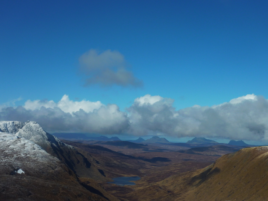
An unusual view of Seanna Bhraigh and the Assynt hills from Carn Mor, Freevater Forest
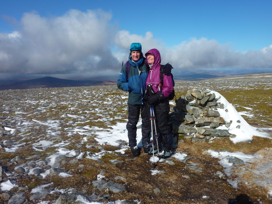
Summit smiles
A "New" Corbett- Cnoc Coinnich Park at the waterfront car park in Lochgoilhead village opposite the Post Office.
Take the track almost opposite the entrance signposted "Cowal Way". There are public toilets on the left here. Follow the path uphill to the edge of the village. Cross the "Dukes Pass" cycle track and follow the clearly marked Cowal Way diagonally uphill with mature coniferous forest on your left. Eventually the path goes through a gate and there is forestry on both sides, but the way ahead is clear enough, leading into the confines of the glen of the Donich Water. The path drops slightly to some pretty waterfalls. Cross a bridge and immediately take the right fork waymarked "Cowal Way and hill path to Coilessan". The path now climbs steeply through the trees. After some time the path comes to a right angle turn and heads even more steeply and now rather wetly uphill through a fire break. A sign indictating "Coilessan" reassures that the correct route is being followed. With some relief the tree line is eventually reached, and the path goes over a stile onto the open hillside. Follow the path, now marked with white marker poles through rather rushy ground until the high point on its traverse to Coilessan, where in good weather the outlines of the Brack and the Cobbler show boldly to the left. The highest point is marked by a Cowal Way waymarker. Here turn rightwards uphill, following the line of the highest ground. A single "main path" has not yet developed, although there were seven walkers on the route in August 2016 so it probably wont be long until there is! A knoll with a prominent steep schist cliff on its North is a good navigation point. Turn it on its right and move onto the high ground, now on short cropped grass. The summit of Cnoc Coinnich now lies ahead and its small summit cairn is easily reached. For those who like that sort of thing, a steep scramble up a short wall from the north can lead directly to the cairn, (entertaining in dry conditions) but the top sectionsl is sloping, mossy and without reassuringly positive holds. The views from the summit are expansive in all directions, to the Arrochar hills, Tarbert and Loch Lomond and south and west down the sea lochs to Ailsa Craig and Arran and the closrer less salubrious landmarks of Coulport and Faslane. We returned by our outward route, but it appears one could also take in the Brack, or on a longer outing Ben Donich too; or make a circuit southwestwards to link up with the Dukes Pass for a return to Lochgoilhead. A version of this report appears on Walkhighlands.com with illustrative photos. Hillwalking Links
As well as the obvious links on the Ochils Mountaineering Club website,we also use such sites as Scottish Hills and Walkhighlands.
If your pronunciation of hill names is causing problems this site may help. Our friends Iain and Jen have a super website called Dreamsofmountains. Check it out. This guy's blog is often amusing 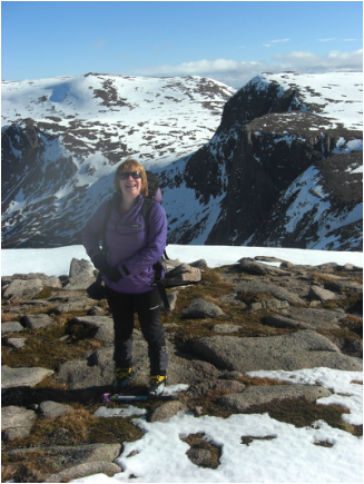
Mhairi enjoying the sunshine after a scramble up Fiacaill Ridge, Cairn Gorm.
|
Create a free website with Weebly